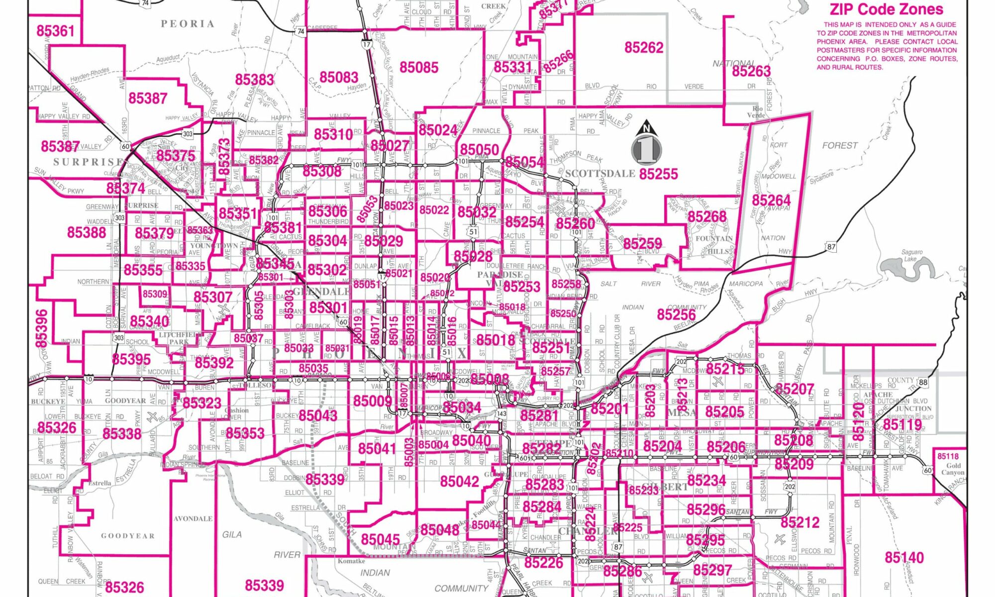
Spokane WA map shown here below and above that is mapped by zip codes zip code zones on a grid system of the Spokane Metro Area. This Spokane zip code map is the most recent 2024-2023 map of Great Spokane Zip Codes.
Spokane WA Zip Code Map
Spokane Washington Zip Code Map
Spokane Washington map shown that is mapped by zipcode and zip code zones This map is the most recent 2024-2023 map of Great Spokane Zip Codes near San Diego and Seattle Washington.
Spokane Zip Code Zones
Spokane Zip Codes List
Let us know what you think about the Spokane zip code maps above in the comments below.
Fascinating to see Spokane broken down by zip code. I wonder if there’s any historical data on how these boundaries were established?
The establishment of zip code boundaries in Spokane, like in many other cities, is primarily influenced by the United States Postal Service (USPS) and its operational needs. The history and evolution of these boundaries often reflect the growth of the city, changes in population density, and the requirements for efficient mail delivery.
Historically, zip codes (an acronym for “Zone Improvement Plan”) were introduced by the USPS in 1963 to streamline mail delivery as cities and their suburban areas grew. The initial assignment of zip codes was based on the ease of delivery routes and the distribution of post offices. Over time, as cities expanded and population patterns shifted, these zip codes were adjusted to accommodate changes.
In the case of Spokane, the historical establishment and changes in zip code boundaries would have taken into account factors like the expansion of the city, the development of new residential and commercial areas, and changes in population. These adjustments ensure that mail delivery remains efficient and effective.
For specific historical data on the establishment and evolution of Spokane’s zip code boundaries, you might need to consult historical records from the local post offices or city planning departments. These sources often have detailed information on how and why certain decisions were made regarding the layout of zip codes. Additionally, historical societies or local libraries in Spokane may have archived materials that provide insights into the city’s postal and urban development history.